RichieMaps
RichieMaps is a attempt to create map data of places I have been to around the world. What I have currently have is a KML file which can be used with Google Maps and Google Earth.
About the Map data
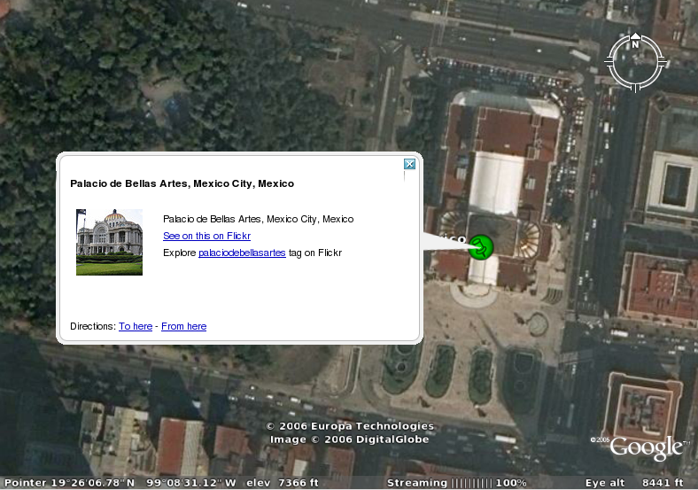
The map data was created by various searches on google maps. google earth and wikipedia. For some places I was able to find the place that the picture was taken very accurately these places are:
- Department of Computer Science, University of Warwick, UK
- MET museum, New York, USA
- Washington Mall, Washington DC, USA
- Tom's Resturant, New York, USA
- Flatiron building, New York, USA
- Asahi Building, Tokyo, Japan
- Palacio de Bellas Artes, Mexico City, Mexico
On Google Earth these places have a green icon.
Google Maps
Just use the following link to view the KML file on Google Maps:
RichieMaps on google MapsGoogle Earth
For Google Earth you will first need to download it if you do not already have it. You will then need to register the KML file with Google Earth using the "Add->Network Link..." menu item (or clicking on it may load Google Earth with it already registered for you)